3888 Stillwell Beckett Rd Oxford, OH 45056

Powering Education: Mapping utility right-of-way using GIS and drone technology
When classroom learning meets real-world utility work, the results can reshape how students prepare for their careers and how organizations approach innovation. That was the case when Miami University’s geographic information system, or GIS, students partnered with Butler Rural Electric Cooperative on a series of drone-based utility inspection projects focused on mapping and evaluating utility right-of-way.
The collaboration began through conversations between Robbyn Abbitt, a Miami University faculty member, and Butler Rural Electric Cooperative’s engineering department during a GIS and drone workshop. What started as a networking discussion quickly evolved into an opportunity for students to apply GIS, drone technology, and field research to utility infrastructure challenges.
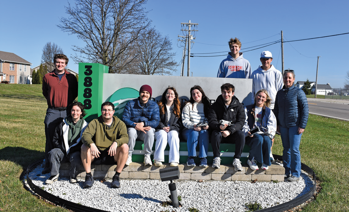
At the center of the partnership was a shared goal — giving students meaningful industry experience while helping the cooperative explore whether drone-based inspections could become a practical in-house solution for monitoring pole lines and utility assets.
Three groups — each including a drone team, GPS team, and data processing team — worked together on the project. One team flew drones while one was on foot, gathering GPS points of the electric assets. The data processing group finalized the field teams’ findings. The groups worked together to make different mapping web applications and dashboards for Butler Rural Electric Cooperative to review.
Butler Rural Electric Cooperative selected project sites that are outage-prone and close in proximity to the cooperative’s office and Miami University’s campus. The cooperative’s engineering department focused on areas that would show students the difficulties the cooperative, utilities, and the energy industry face and how GIS and drone technology tools can help.
For students, the project extended far beyond technical GIS exercises. Teams were expected to communicate professionally with clients, manage timelines, divide responsibilities, and deliver polished reports and presentations. Students also had to adapt quickly in the field by learning drone operations, troubleshooting GIS databases, and working through unpredictable weather conditions.
“Real-world applications are critical to preparing students to be competitive in the job market,” says Robbyn Abbitt, Miami University professor and Butler Rural Electric Cooperative member. “The more students are exposed to how industry applications work for organizations, the more comfortable they are in those environments.”
One student team focused on Governor Bebb MetroPark in Okeana, where the cooperative’s engineering department is exploring the conversion of overhead utility infrastructure to underground service to improve reliability in an outage prone corridor. Using drones, the students mapped utility poles, analyzed potential flight paths, and identified environmental obstacles along
the route.
Samantha Besel, a junior majoring in zoology and environmental science, said the project aligns closely with her interest in forestry and environmental work. She also noted one of the most valuable lessons came from collaborating within a team. “We were able to pave our own path at some point in the project,” she reflected afterward, highlighting the balance between structure and independence that defined the experience.
Another group conducted a GIS-based assessment at Butler Rural Electric Cooperative’s community solar field in Oxford. By capturing aerial imagery and managing large datasets, students evaluated site conditions and infrastructure health while gaining experience with advanced GIS applications and data management platforms.
A third team surveyed a utility line corridor between Booth Road and Talawanda High School, examining the condition of poles across rural terrain. Their final map identified poles in good condition as well as assets requiring maintenance or replacement. During the inspection process, students even discovered pole damage caused by woodpeckers near the top of one structure. This is an example of the detailed observations drone technology can reveal.
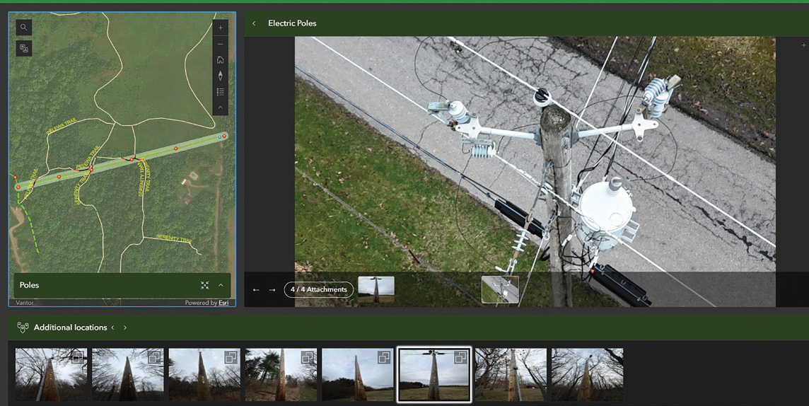
Above, final maps identified poles in good condition as well as assets requiring maintenance or replacement. During the inspection process, students even discovered pole damage caused by woodpeckers near the top of one structure. This is an example of the detailed observations drone technology can reveal.
While the projects produced valuable deliverables for Butler Rural Electric Cooperative, the broader impact is in how cooperative employees prepared students for the realities of professional GIS and utility work. Field conditions were not always ideal. Bitter cold, high winds, equipment issues, and data inconsistencies all became part of the learning process. “I was surprised how the students adapted well to challenges,” says Joshua Smock, Butler Rural Electric Cooperative’s GIS and engineering specialist. “They stayed engaged and curious, asking questions all semester.”
In the end, success was measured not only in maps, imagery, or inspections completed, but in confidence gained. Students left the experience with professional-level projects, client interaction experience, and a clearer understanding of how GIS technology supports modern utility operations. For Butler Rural Electric Cooperative, the partnership demonstrated that drone-assisted inspections could be practical and effective for future in-house operations.
As utilities increasingly rely on GIS, remote sensing, and drone technology, collaborations like this help build the next generation of professionals ready to power the industry forward.